
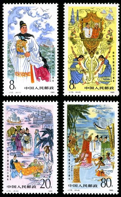
J113, 580th Anniv. of Zheng He’s Expedition to Seas《郑和下西洋五百八十周年》
Stamp Title: 580th Anniv. of Zheng He’s Expedition to Seas
Scott No: 1992,1993, 1994, 1995
Serial number: J113
Values in set: 4
(4-1), Great navigator Zhen He, 8 fen, 31*52 mm
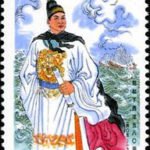
(4-2), Emissary of peace, 8 fen, 31*52 mm
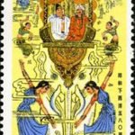
(4-3), Trade and culture communication, 20 fen, 31*52 mm
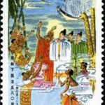
(4-4), Great emprise in navigation history, 80 fen, 31*52 mm
Date of issue: July 11, 1985
Denomination: 116 fen
Designers: Li Dawei
Size of stamps: 31*52mm
Perforation: 11.5
Sheet composition: 40(10*4)
Printing process: Photogravure
Printing House: Beijing Postage Stamp Printing Works
During the reign of the emperor Zhu Di the Ming Empire became stronger and the its economy flourished. To make China’s strength known to the world and to spread Chinese culture, Zhu Di sent Zheng He with his ship team on oversea voyages. Zheng He was a eunuch from a family of Hui nationality. From 1405 to 1433 Zheng made seven voyages and performed miracles in the history of ocean£going navigation.
Zheng He’s ocean going team had a hundred vessels and a crew of 30,000. It was the largest one in the world at that time.
The Ming Dynasty was a golden age of ship building. China then had large shipyards.
The large vessel Zheng He used was 120 metres long and 45 metres wide. The twelve sails on the ship could be adjusted in accordance with the wind directions. The ship had separate water£tight cabinets to keep the ship afloat. Because the cabinets were separated and water£tight, even if the ship stroke a reef at some cabinet, the whole ship would not sink. In the 18th century, this structure arrested the Westerners’ attention and was gradually adopted by them.
Zheng He’s team used the compass, the most advanced navigation instrument of the world of his day. They detected directions by the compass and located geographical positions by observing the altitude of stars. The combined application of nautical astronomy and compass navigation greatly increased the accurateness of their position fixing during the voyages. This technical advancement offered Zheng’s ship team greater freedom.
The Route Chart of Zheng He’s Voyages included 30 Asian and African countries and regions, 530 places, and topographical features like mountains, islands, reefs and so on. Directions in the compass and the depth of water were signed at important points on the navigation lines. This is the first ocean£going voyage chart in China, and one of the earliest in the world.
Zheng’s ship team made seven voyages through untold hardships. It went through the South China Sea, the Java Sea, the Strait of Malacca, the Persian Gulf, the Red Sea and the Indian Ocean and reached the eastern coast of Africa. It visited 30 Asian and African countries including Vietnam and Indonesia. The route totaled to 500,000 kilometres. This was unprecedented in the history of ocean navigation.
Zheng reached India 90 years earlier than Vasco da Gama’s arrival there by way of Good Hope Cape, and 80 years earlier than Christopher Columbus’ arrival at America, the so£called New Continent.
Wherever Zheng He went, he brought gifts and granted titles from the Ming emperor to the local rulers, meaning to establish a broad tribute£paying circle. At the same time, Chinese calendar and ritual system were introduced to those countries.
Zheng’s ship team also did trade and exchanged goods with other countries. The ship team was equipped with strong arms, which however was seldom used. Zheng was more like a good will ambassador than a war ship commander or a boss of a merchant group.
Zheng’s voyages enriched the humankind’s knowledge about navigation. They opened up the traffic route on the Asian and African seas, and promoted economic and cultural interchange. They created the brilliant record in Chinese people’s adventures in conquering the seas.
-

- (4-1), Great navigator Zhen He, 8 fen, 31*52 mm
-
- (4-2), Emissary of peace, 8 fen, 31*52 mm
-
- (4-3), Trade and culture communication, 20 fen, 31*52 mm

-
- (4-4), Great emprise in navigation history, 80 fen, 31*52 mm
J113 郑和下西洋五百八十周年
发行日期:1985.7.11。影写版。P11.5。 31mm*52mm。 40(10*4)。 [G]。
设计:李大玮。印制:北京邮票厂。
4-1为“伟大的航海家郑和”。画面上,一位谦和、英武的壮年宦官,头戴内使乌纱,袍绣金色坐蟒,手持一卷航海图,目光射向远方,背后是风云变幻的大海波涛,衬托了这位伟大航海家的风姿。
4-2为“和平的使者”。画面为郑和古里之行。根据有关史料记载,郑和船队曾经到过印度不少地方,如古里(今印度科泽科德)、柯枝(今印度柯钦)、小葛兰(今印度奎隆)、加异勒(今印度半岛南端东岸和阿枝巴丹、甘巴里)等地。画面展现了印度官员陪同郑和乘象游览、群众载歌载舞欢迎的场面。画面舞蹈采用了印度古典舞蹈“波罗多”舞,背景是印度的古建筑和船队。
4-3为“贸易与文化交流”。画面选择了与阿丹通商的情形。据史书记载,郑和船队曾到达属于阿拉伯地区的有“祖法儿”、“阿丹”、“尺方”等国。这些国家在马欢的《瀛涯胜览》和费信的《星槎胜览》中都有详细记载。邮票设计者参考了日本出版的《阿拉伯帝国遗产》,因而邮票画面的建筑、服装、道具等都实有所据。为了真实表现古代海上丝绸贸易的特点,作者甚至在画面的丝绸上也细致地采用了“明代黄地缠枝花缎”的古代图案。
4-4为“航海史上的壮举”。画面是郑和到达东非的情形。根据史书记载,郑和船队曾到属于非洲地区的有十剌哇、竹箭、木骨都东、麻林、剌撒、孙剌等国。这一幅选用了夜景作为背景,皓月当空,祥云瑞霭,一派月明风清的胜景,非洲人民热烈欢迎东方的使者。
本套邮票在艺术上完全采用中国画法,以工笔重彩为基础,但用的是生宣纸,这就使得线条的勾勒、颜色的渲染更加生动。本套邮票富于民族特色,充分表现了图画的意境,是邮票中极富艺术性的精品。
郑和(1371—1435),本名马和,回族,云南晋宁人。因随燕王朱棣起兵有功,赐姓郑。任内宫监太监。郑和是我国明代伟大航海家。在1405年至1433年的28年间,他先后七次率领明朝船队远航,到达30多个国家,最远到达非洲东海岸。他是和平的使者,开辟了中国与亚、非各国的政治联系。郑和每到一地,都用中国产的磁器、丝绸、金银等物品换取当地特产,促进了中国与亚非各国的经济和文化交流。郑和的远航比哥伦布、达·伽马的航行要早半个多世纪。当时郑和所乘船只最大的长约150米,宽约60米,可容1000人,船队规模很大。1985年是郑和下西洋580周年,为纪念这一世界航海史上的壮举,邮电部特发行这套纪念邮票。本套邮票共4枚。
Leave A Comment
You must be logged in to post a comment.